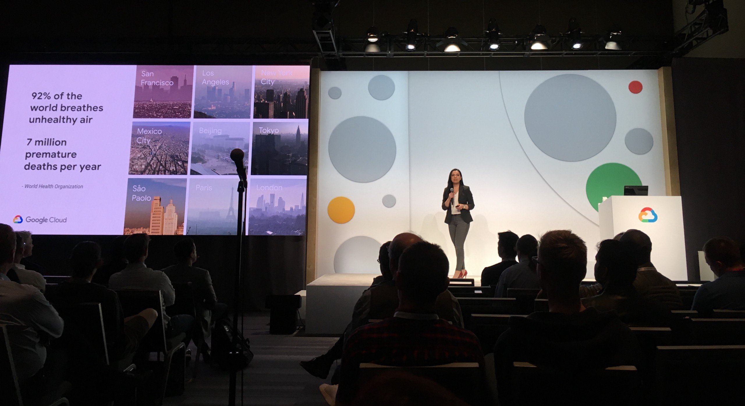
Last month at GreenBiz’s VERGE Conference, Aclima, and our partners at the U.S. Environmental Protection Agency (EPA), and Google Earth Outreach participated in a panel discussion about our work together to visualize city-scale pollution at the street level, in real time.
Davida Herzl, Aclima’s CEO, was joined by Dan Costa, Program Director for Air, Climate, and Energy Research at the EPA and Karin Tuxen-Bettman, Program Manager at Google Earth Outreach. The panel discussion was moderated by award-winning journalist, Heather Clancy, Green Biz’s Senior Writer specializing in coverage of transformative technology.
Below is a recap of the panel, highlighting the top questions and the answers panel members provided.
Heather Clancy to EPA: What is the EPA’s involvement in this partnership with Aclima? What got you guys excited?
Dan Costa: We developed a cooperative research development agreement with Aclima to combine both sets of expertise in development and deployment. We had a vision that as sensor technology advances, and the density of sensors increases, activities like Google’s Street View air quality mapping will become game changing. We can statistically combine air quality models, mathematical models and satellite data to achieve long-term goals. We want to create a fabric that provides a granular view across the country of air quality that can ultimately be brought into our own research.
Heather to Aclima: Was the EPA a target partnership for you, did you think about it in the business model from the beginning?
Davida Herzl: Absolutely. We want to affect large scale systems, so we thought about our role in the world as a part of a system, and we need to partner with other groups that are a part of the existing ecosystem. The EPA appreciates that we have some of the world’s leading atmospheric and measurement scientists. Before we put this new information into the hands of the world and decision makers, we want to make sure our data quality reaches the highest standards. People are really excited about the Internet of Things but people aren’t talking about data quality in sensors. It’s really important to us as we’re making sensors cheaper and getting them into the hands of the public, and that we are participating in defining the scientific data quality standards.
Heather to Aclima: What is the particular quality concern regarding data, is it just a matter of accuracy?
Davida: Sometimes with sensors the data can drift, creating this gap in truth. But what Aclima is doing is leveraging cloud computing and leading science to really extract the best quality data from sensors possible. We’re making some really big advancements in our technology to deliver a sensor that can compete against reference equipment that is hundreds of thousands of dollars and have it deliver the same quality data. That’s the vision. So it becomes quicker and cheaper to get a lot of those measurements into the world.
Heather to Aclima: How could sensors develop into a citizen driven data collection device or application?
Davida: As we collect this data, context really matters. Sensors are a very powerful source of that context. With all these emerging different data sets, citizens could be a very powerful part of adding to these data sets.
Heather to Google: What was so compelling about this collaboration to Google? What do you hope to get out of it and what do you feel that you are contributing to it?
Karin Tuxen-Bettman: A couple years ago when we were introduced to Aclima, we were excited because we thought this could make a big difference to the world’s air. Everybody, whether they realize it or not, cares about air quality. So helping people to make sense of [air quality data] with a collection of partners to help compute the data, process that data and then surface it, let’s say as a smartphone application, will impact everyday decisions. This sort of information is going to be made readily available in the very near future, and that’s what excites us. We’ve committed to mapping 3 communities of California for next year, so we’re really trying to figure out how this can scale.
Heather to Aclima: So what is it about now that makes this possible in terms of sensor technology?
Davida: It’s not any one technology, it is the convergence of several technologies. It’s cloud computing, deep learning, small scale sensing coming together that is enabling us to really make some breakthroughs right now that weren’t possible a few years ago. This new technology is converging with this massive societal demand for environmental data. People are starting to understand that sustainability isn’t just about a greener planet, it translates directly into their health. The same emissions that are changing the planet are changing our bodies.
Heather to Panel: So what does this output look like, what will the Maps plus data show? How is it going to be expressed, how will the average person use this information?
Davida: Right now the data is delivered in such a way that we can visualize and analyze it in any number of ways. The scale of these data sets are just massive. One of the reasons we’re so excited to partner with Google is not only the Street View platform, but their ability to provide us a platform to scale quickly. Once we are confident that the data quality we are finding is providing the level of quality we want, we can very quickly scale to all major global urban centers. The other aspect of the Google partnership that is so exciting is the Maps distribution. We would love to see our layer of air quality data available for view on Google Maps.
Karin: We’re collecting environmental data, and after it’s qualified and validated we’re sharing it with the EPA, Google’s science partners, and of course the whole team over at Aclima. What Google plans to do with this data is put it on Google Earth or Google Earth Engine for scientists to link the air quality data with other data. This seems like the best fit for this scale of big data: handing the information to scientists so they can make the insights. The data will be phased, but I promise you it will be released to the public. The reason it will be phased in at this early stage is because we are in a very deliberate validation period to understand how this data can be used. Aclima, Google and the EPA are all dedicated to putting this data out there.
Heather to Aclima: How have the municipalities been involved in the three areas you’ve committed to mapping?
Davida: We’re engaging with the communities that we are going into. This outreach is helping to guide what we’re looking to do. We want to engage and understand what problems they’re dealing with.
Question from Audience to Group: What does the transition to real-time data looking like?
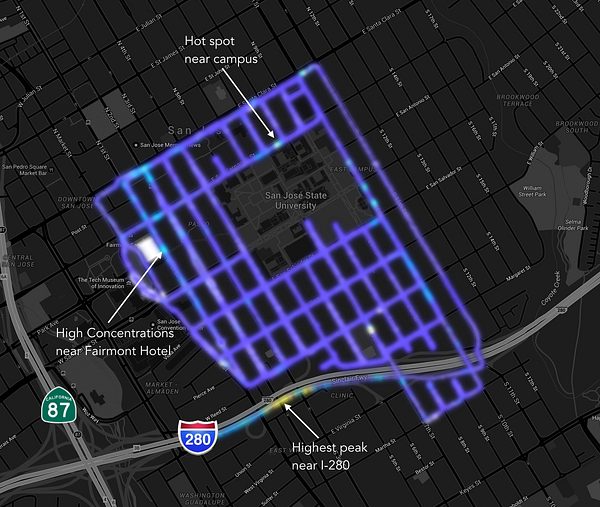
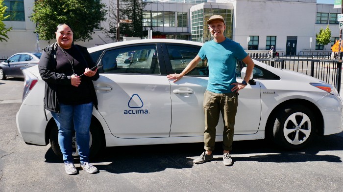
Davida: The data that is read by sensors attached to Street View cars are registering in real time. But for long-term measurements to the community, one of the challenges with deploying sensor networks is that there isn’t really a body of knowledge on how or where to deploy these sensors. What’s great about the Street View cars is that it helps us identify hotspots, so they become targets for stationary sensors that can collect long-term data. So it really helps us plan long term stationary sensors.
Karin: In order to get that spatially granular model of air quality of neighborhoods, it’s going to take some time. We’re focused right now on working with scientists that can build interesting insights and use that to build models.
Heather to Aclima: What are your plans for verifying the data collected? How do you know when something’s out of calibration? How do you know what you are collecting is true and trustworthy?
Davida: So there are a couple of processes to do that. For one, we have scientists who apply rigorous scientific standards to our work. We’re also partnering with research organizations that are validating our processes, methods and models of work, to really get that out there and validated by the scientific community. That is one of our commitments under our cooperative research and development agreement. Independently of that, we are reviewing our work with a panel of independent scientists who are giving us feedback and making sure we maintain strict standards.
Heather to Panel: What about the ever present security question? How do you protect this information from getting into the wrong hands?
Davida: The information is here, we just haven’t turned them into 0’s and 1’s to make them broadly available to everyone.
Dan: When you put out information to the public, you want that information to be as accurate and precise as possible through the right independent verification.
Karin: You also want to have the right context around it so people can make the right insights and decisions. There is a million ways to interpret, misinterpret, data.
Heather to Panel: Without locking you guys down to an exact timeline, what is the hope for when this data will be made available?
Davida: I will say our capabilities are changing so fast. Last year when we did the Denver study, we could not have predicted that we were going to commit to mapping all over California. It is difficult to predict, but we want to move as quickly as we can.
Karin: Getting the analysis, building the predictive algorithms — things like that — will take time to do properly, but once we have something that’s worth scaling, we can move pretty quickly.
Share this
Mapping Air Quality and Greenhouse Gases on Every Block in the Bay Area
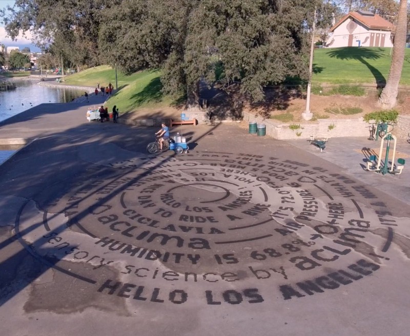
Taking it to the Streets: Aclima Brings Street-Level Environmental Sensing to CicLAvia